I take on GIS and remote sensing work.
Most of what I've mapped so far is in Punjab and Delhi. Groundwater by district, surface water from Sentinel-2 and Landsat, and the land around industrial units. A few of those maps are below, along with the field side of what I do.
MSc Geoinformatics, Panjab University. Research intern at IIT Roorkee in 2026.
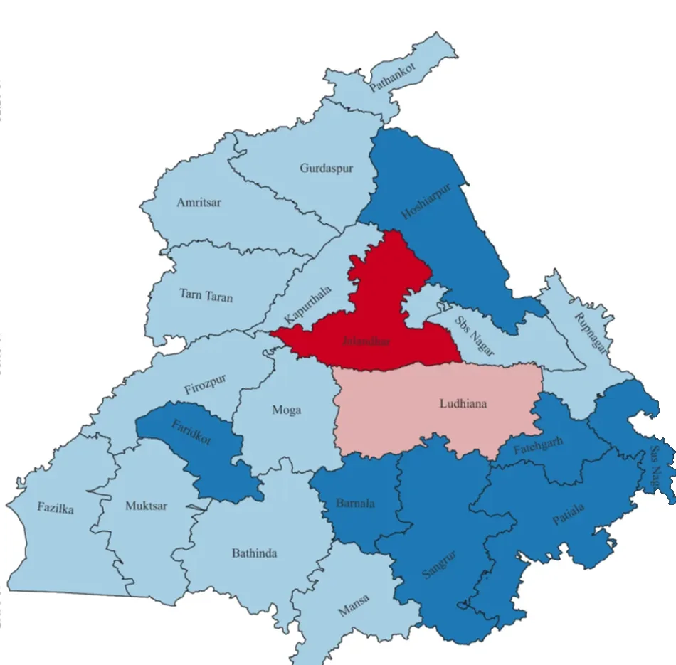
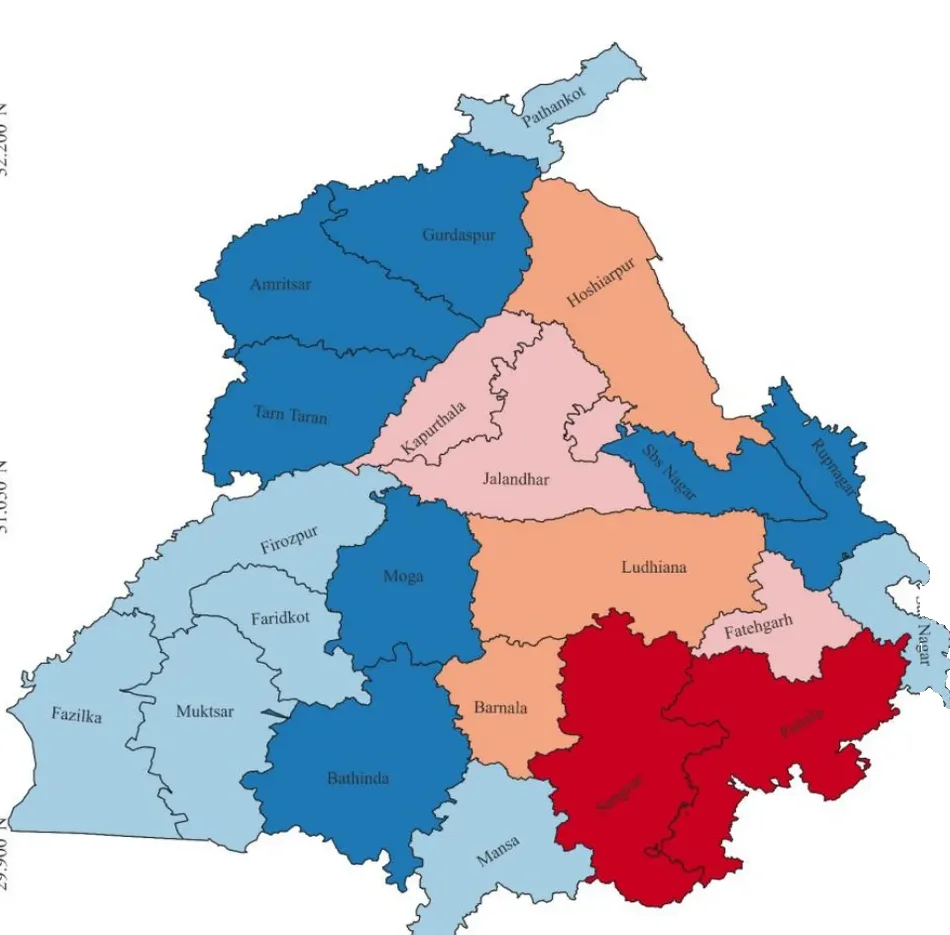
Punjab's groundwater table, district by district.
Drag across the map to compare 2000 to 2010 with 2010 to 2025. Jalandhar and Ludhiana changed the most, and Jalandhar reached critical. Several districts in the south-west and west went the other way, with the water table rising.
- Shallow
- Moderately deep
- Deep
- Very deep
- Critical
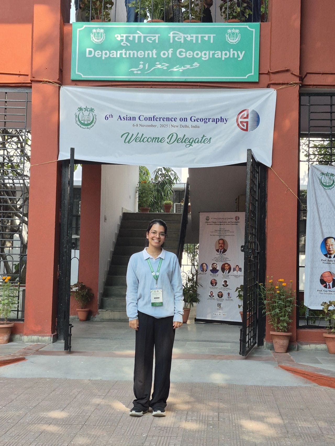
From my paper “Assessing Water Indices for Sustainable Agriculture in Punjab”, 6th Asian Conference on Geography, 2025. Slides, PDF
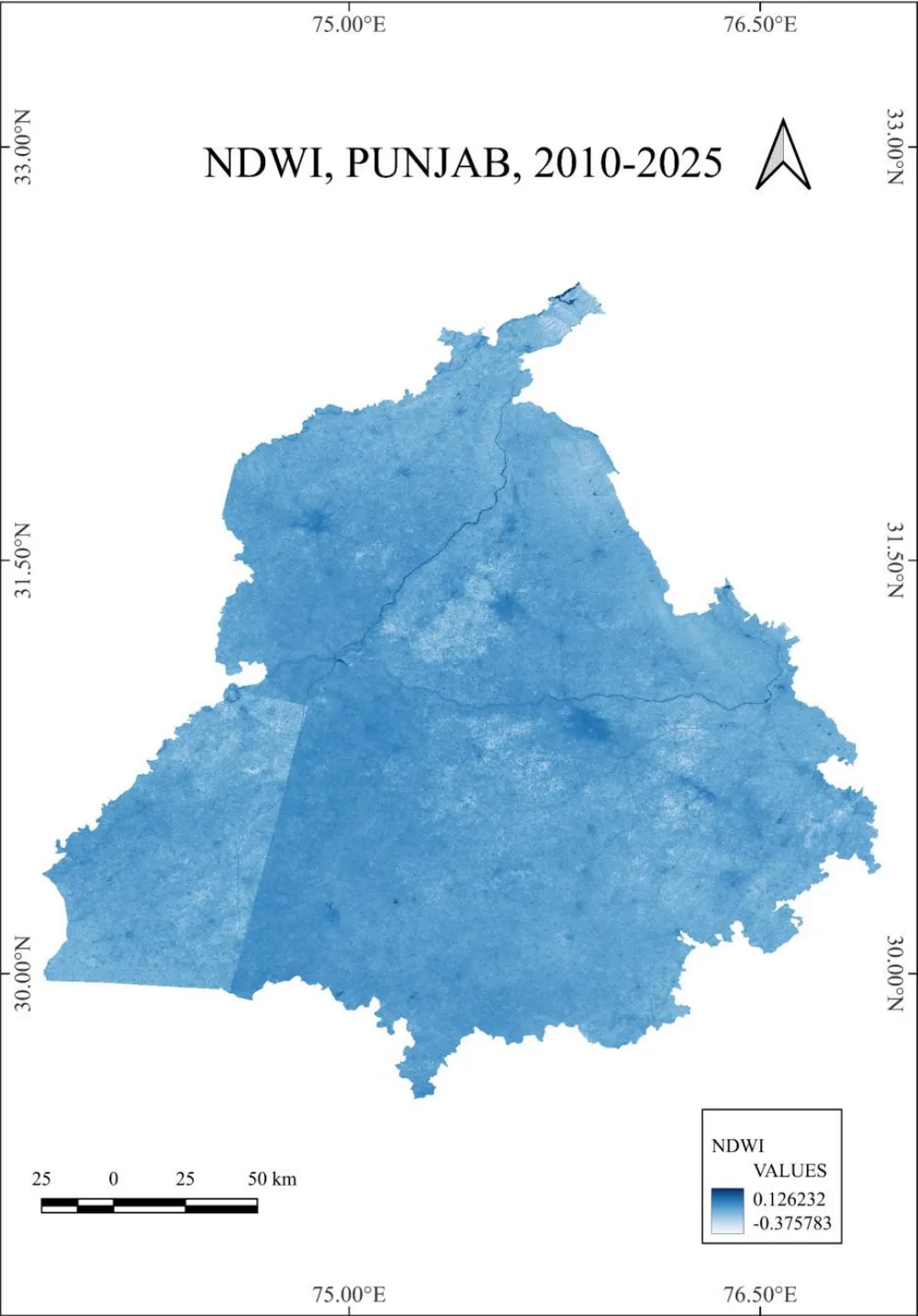
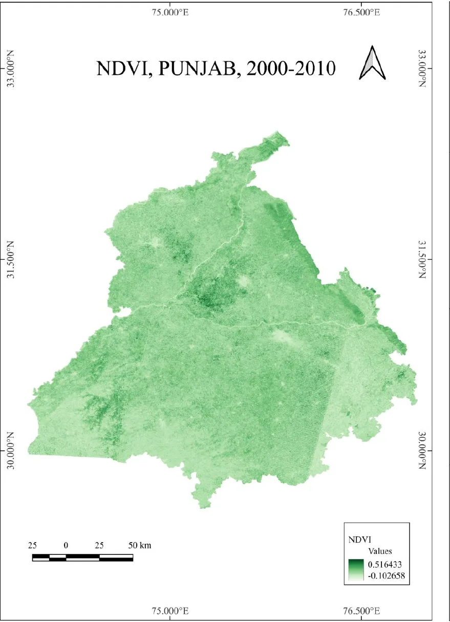
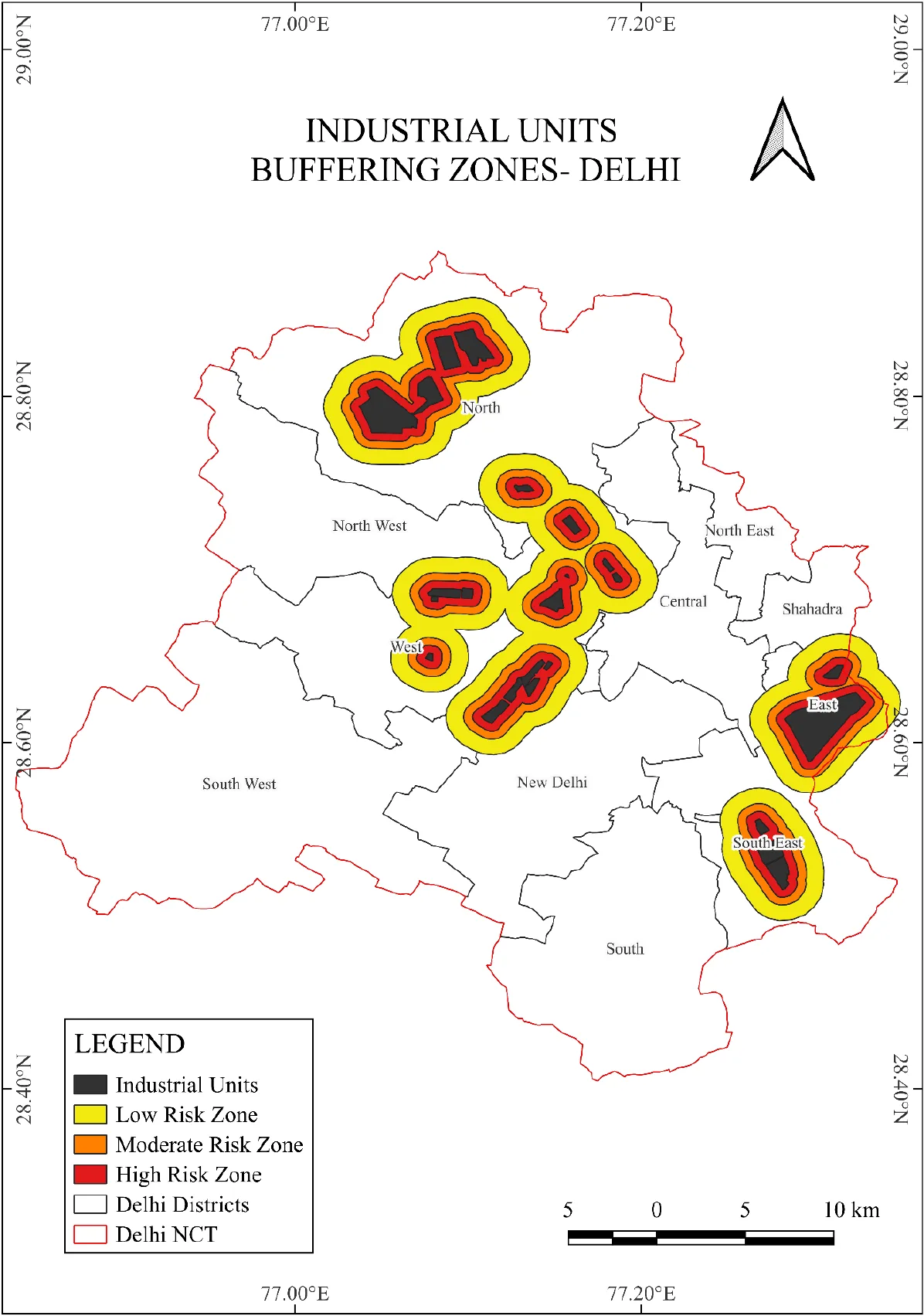
Three questions you can answer from the maps above.
Scroll back up if you need to. Nothing gets sent anywhere.
- 1
On the 2010 to 2025 groundwater map, which district is marked critical?
- 2
In the Delhi map, how far out from an industrial unit does the high-risk buffer reach?
- 3
NDWI picks out surface water. Between the two decades, where in Punjab did it fall?
0 of 3 answered
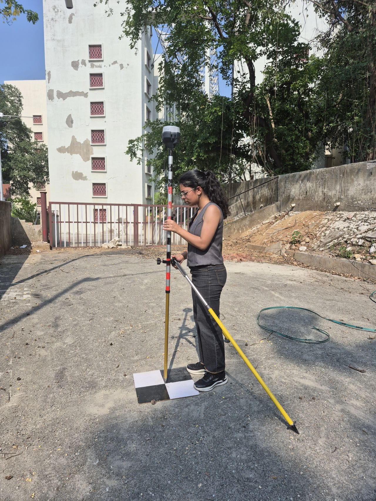
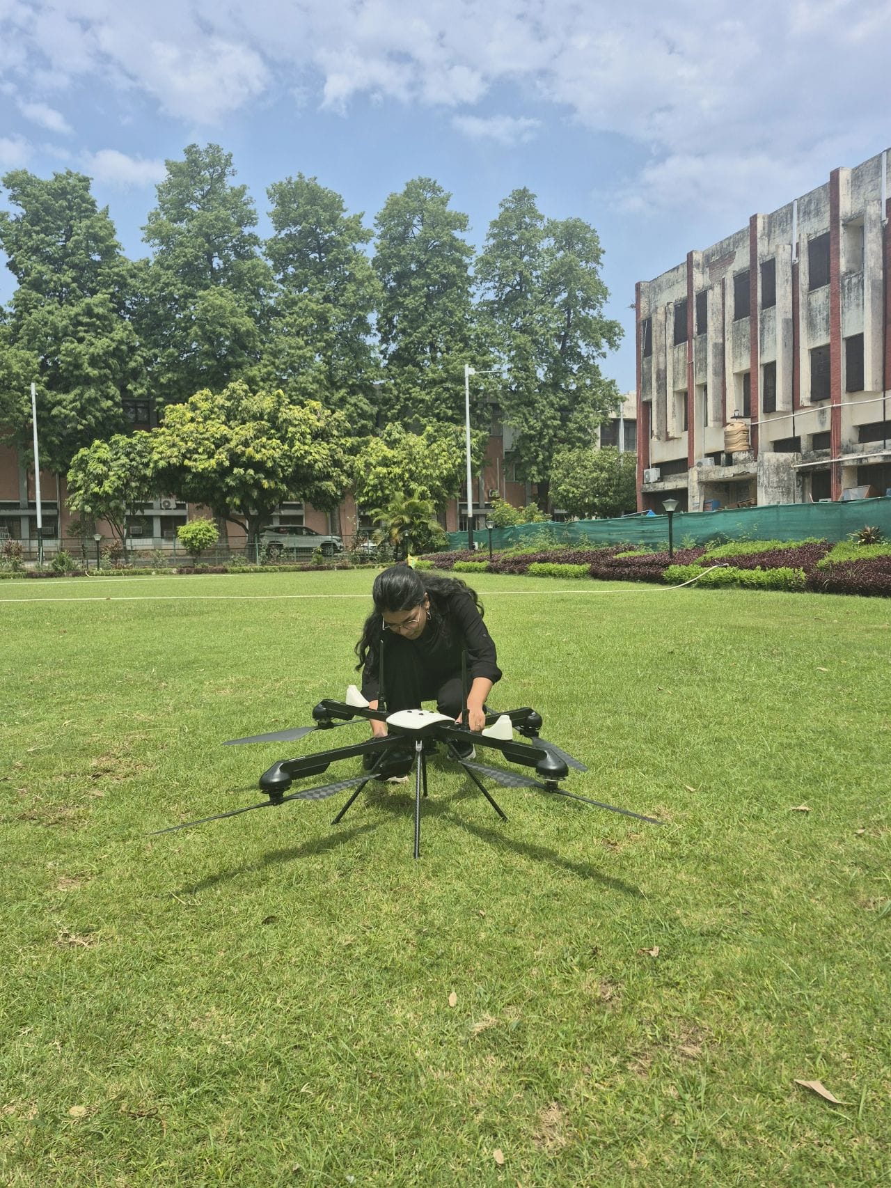
Some of the work happens outside, with a rover pole and a drone.
Satellite analysis
Spectral indices such as NDVI, NDWI and NDBI from Sentinel-2 and Landsat, worked in QGIS or ArcGIS Pro and compared across years for the same area. The Punjab maps on this page are this kind of work.
Ground control for drone surveys
Setting out and observing control points so the orthomosaic sits on real coordinates. I did this at IIT Roorkee with an Emlid Reach RS3 and a Trimble DA, then helped process the photos into orthomosaics and surface models.
Maps for research and reports
If your team has the data but no one with time to turn it into figures, that's the job I like most. Buffer analysis, district maps, the figure for page 12 of the report.
Writing
Technical articles and tutorials on geospatial tools. Before my MSc I wrote for Bhu Chintan and Janhit Times.
You'll know what you're getting before I start.
- 01
You write to me
A few lines on the question, the area and the data you already have. A shapefile or a screenshot of the area helps more than a long brief.
- 02
I come back with a plan
Once I've looked at the data, you get the method, what you'll receive and when, before any work starts.
- 03
The work
If a choice comes up that changes the result, like which years to compare or how to class the map, I'll ask rather than guess.
- 04
Hand-over
Maps, the data behind them and a short note on how they were made, so someone else can redo it.
- What kinds of projects do you take on?
- Satellite index analysis, ground control for drone surveys, maps and figures for research teams and NGOs, and technical writing about geospatial tools. Most of what I've done so far is in Punjab and Delhi, with Sentinel-2, Landsat, QGIS and ArcGIS Pro.
- Are you open to contract or part-time roles?
- Yes. I take on project-based and part-time contract work alongside my MSc, remotely or on site around Chandigarh.
- How is a project priced?
- Each project is scoped on what it involves, so there's no fixed rate card. Send a short brief and I'll come back with a proposal and a timeline.
- Do you work with teams outside India?
- Yes. I work remotely over email and video calls, and can invoice through the usual international platforms.
Want to see more first? Case studies
Tell me about your project.
A link, a few lines on what you have in mind and a rough timeline is plenty. I usually reply within two working days.
jannatkhosla0401@gmail.com