Resourcesat-2A LISS-IV Explained: Bands, Resolution and Use Cases
A practitioner-oriented reference explaining Resourcesat-2A LISS-IV's spectral bands, 5.8 m resolution, and how it compares to Sentinel-2 and Landsat for India-specific mapping workflows.
Why LISS-IV Still Matters in an Era of Open Satellite Data
India's land and agriculture monitoring ecosystem runs on ISRO data. While Sentinel-2 and Landsat dominate global open-data workflows, a significant portion of India's operational mapping, from district-level crop surveys to forest boundary delineation, depends on the Resourcesat series. Yet when I talk to students or junior GIS professionals, there is a recurring gap: they know the sensor exists, but they cannot articulate what LISS-IV actually measures, how its bands compare to alternatives, or when to choose it over freely available options. This article is my attempt to fill that gap with a clear, practitioner-oriented reference.
What Is the Resourcesat-2A LISS-IV Satellite?
Resourcesat-2A is an Earth observation satellite launched by ISRO in December 2016 as a continuity mission for Resourcesat-2 (launched 2011). The satellite carries three sensors: LISS-III (medium resolution, multispectral), AWiFS (wide field, coarse resolution), and LISS-IV, the focus here.
LISS-IV stands for Linear Imaging Self-Scanning Sensor IV. It is a high-resolution, pushbroom scanner designed for detailed land-cover mapping, cadastral-level work, and applications that demand fine spatial discrimination within India's diverse agro-ecological zones. The Resourcesat-2A LISS-IV satellite is operated by ISRO and data is disseminated through the National Remote Sensing Centre (NRSC), Hyderabad.
What Are LISS-IV's Spectral Bands and Spatial Resolution?
This is where practitioners need precision. LISS-IV operates in three spectral bands:
| Band | Wavelength Range | Common Name |
|---|---|---|
| B2 | ~0.52 – 0.59 µm | Green |
| B3 | ~0.62 – 0.68 µm | Red |
| B4 | ~0.77 – 0.86 µm | Near-Infrared (NIR) |
A few things to note immediately:
- No Blue band. Unlike Sentinel-2 or Landsat 8/9, LISS-IV does not carry a blue channel. This limits certain atmospheric correction approaches and rules out true-colour composites using native bands.
- Spatial resolution is approximately 5.8 metres in multispectral mode, making it one of the finest-resolution multispectral sensors in India's civilian satellite fleet.
- LISS-IV also has a panchromatic mode (single band, covering roughly 0.5–0.75 µm) at the same nominal resolution, which can be used for pan-sharpening or standalone high-detail mapping.
- The swath width in multispectral mode is around 23.9 km, which is narrow compared to LISS-III (~141 km) or AWiFS (~740 km). This means revisit frequency for a specific location is lower unless off-nadir viewing is used, ISRO can tilt the satellite to improve revisit.
The combination of ~5.8 m resolution and three multispectral bands places LISS-IV in a practical middle ground: finer than Sentinel-2's 10 m bands, but without Sentinel-2's broader spectral range (13 bands including red-edge and SWIR).
How Does LISS-IV Compare to Sentinel-2 and Landsat?
This is the question I get most often, and the honest answer is: it depends on your application.
Spatial resolution advantage: For applications where field-level discrimination matters, small agricultural plots, urban tree canopy, narrow riparian buffers - LISS-IV's ~5.8 m resolution outperforms Sentinel-2's 10 m multispectral bands. In India, where average farm holdings are small and fragmented, this difference is operationally significant.
Spectral disadvantage: Sentinel-2 carries red-edge bands (around 705 nm, 740 nm, 783 nm) that are highly sensitive to chlorophyll content and crop stress. LISS-IV has no red-edge capability. Similarly, Landsat 8/9 and Sentinel-2 both offer SWIR bands, which are invaluable for soil moisture estimation, burn scar mapping, and mineral discrimination. LISS-IV cannot do any of these.
Data access: Sentinel-2 and Landsat data are globally free and accessible via platforms like Google Earth Engine, Copernicus Open Access Hub, and USGS EarthExplorer. LISS-IV data is available through NRSC's Bhoonidhi portal, and while ISRO has made significant strides in data democratisation, access workflows remain less seamless for many users compared to the Copernicus ecosystem.
Temporal resolution: Sentinel-2's twin-satellite constellation achieves 5-day revisit at the equator. LISS-IV's narrow swath means revisit for a given location can be longer unless off-nadir tasking is requested, a consideration for time-sensitive crop monitoring.
What Are the Primary Use Cases for LISS-IV?
Given the sensor's characteristics, here are the applications where LISS-IV genuinely excels:
- Cadastral and revenue mapping: The ~5.8 m resolution allows delineation of individual field boundaries, which is directly useful for land records modernisation programmes like DILRMP (Digital India Land Records Modernisation Programme).
- Urban land-use mapping: Discrimination of built-up classes, road networks, and green spaces at the neighbourhood level is feasible where Sentinel-2 would merge adjacent features.
- Crop type mapping in small-holder landscapes: In states like Punjab, Haryana, and parts of Maharashtra, even at 10 m resolution, mixed pixels are a problem. LISS-IV reduces this significantly.
- Forest patch delineation: Detecting small forest fragments, forest encroachments, and plantation boundaries benefits from the finer spatial grain.
- Coastal and wetland mapping: Narrow creek systems, mangrove patches, and tidal mudflats that are sub-pixel at 10 m become mappable at ~5.8 m.
A Worked Example: Mapping Kharif Crop Boundaries in a Fragmented Landscape
Suppose you are tasked with mapping rice and sugarcane boundaries in a district in western Uttar Pradesh during the Kharif season (July–October). Here is how LISS-IV fits into the workflow:
- Acquire a cloud-free LISS-IV multispectral scene from NRSC Bhoonidhi for your district, targeting August–September when crop canopy is near-maximum.
- Compute NDVI using the Red (B3) and NIR (B4) bands:
NDVI = (B4 - B3) / (B4 + B3). At ~5.8 m, individual rice paddies of even 0.1 ha are resolvable. - Use the Green band (B2) to help separate water bodies (flooded paddies) from established rice crop, flooded paddies show low NIR and moderate green reflectance, while established rice shows high NIR.
- Overlay with revenue parcel boundaries (from state land records) to assign crop labels to individual parcels, something that would produce significant mixed-pixel errors at 10 m.
- Validate using field GPS points or high-resolution Google Earth imagery for the same date.
This workflow is operationally used by state remote sensing centres and agricultural departments across India. LISS-IV's resolution makes the parcel-level assignment reliable in a way that Sentinel-2 alone cannot guarantee in fragmented landscapes.
Limitations to Keep in Mind
No sensor is universal. Be aware of these constraints when planning LISS-IV-based projects:
- The absence of SWIR and red-edge bands means you cannot directly compute indices like NDWI (SWIR-based), NBR (Normalised Burn Ratio), or red-edge NDVI without fusing with another sensor.
- Narrow swath increases the number of scenes needed for large-area mosaics and complicates cloud-free compositing.
- Data latency and access through Bhoonidhi, while improving, requires registration and sometimes involves costs for high-resolution products, unlike fully open Copernicus data.
- Atmospheric correction tools optimised for LISS-IV are less mature than those for Sentinel-2 (e.g., Sen2Cor) or Landsat (e.g., LaSRC).
Practical Recommendation
My general guidance: use LISS-IV when spatial resolution is the binding constraint, small plot mapping, urban feature extraction, narrow linear features. Combine it with Sentinel-2 when you need spectral depth (red-edge, SWIR) alongside fine spatial detail, treating the two as complementary rather than competing. For national or regional scale time-series work where revisit frequency and spectral range matter more than sub-10 m resolution, Sentinel-2 or AWiFS may serve you better.
The Resourcesat-2A LISS-IV satellite remains an underutilised asset in many practitioners' toolkits, partly because of data access friction, partly because of unfamiliarity with its specific strengths. Knowing exactly what it offers, and where it falls short, is what separates a competent GIS professional from one who simply defaults to whatever is easiest to download.
Frequently asked questions
What is the spatial resolution of Resourcesat-2A LISS-IV imagery?
LISS-IV multispectral imagery has a spatial resolution of approximately 5.8 metres, making it one of the finest-resolution multispectral sensors in India's civilian satellite fleet and sharper than Sentinel-2's 10-metre bands.
Does LISS-IV have a blue band for true-colour images?
No, LISS-IV only carries green, red and near-infrared bands and has no blue channel, which limits certain atmospheric correction methods and rules out true-colour composites made from its native bands alone.
Can you calculate NDWI directly from LISS-IV data?
No, because LISS-IV lacks a SWIR band, you cannot directly compute indices like NDWI or NBR from it without fusing the data with another sensor that provides SWIR bands.
How does LISS-IV's swath width compare to LISS-III?
LISS-IV's multispectral swath is around 23.9 km, much narrower than LISS-III's roughly 141 km, meaning more scenes are needed for large-area coverage and revisit frequency is lower unless off-nadir tasking is used.
References
- ISRO Resourcesat-2A Mission Overview: https://www.isro.gov.in/Resourcesat2A.html
- NRSC Bhoonidhi Data Portal: https://bhoonidhi.nrsc.gov.in
- NRSC Satellite Data Products: https://www.nrsc.gov.in/Satellite_Data_Resourcesat2A
- Copernicus Sentinel-2 Mission Guide (ESA): https://sentinel.esa.int/web/sentinel/missions/sentinel-2
Researched and drafted with AI assistance.
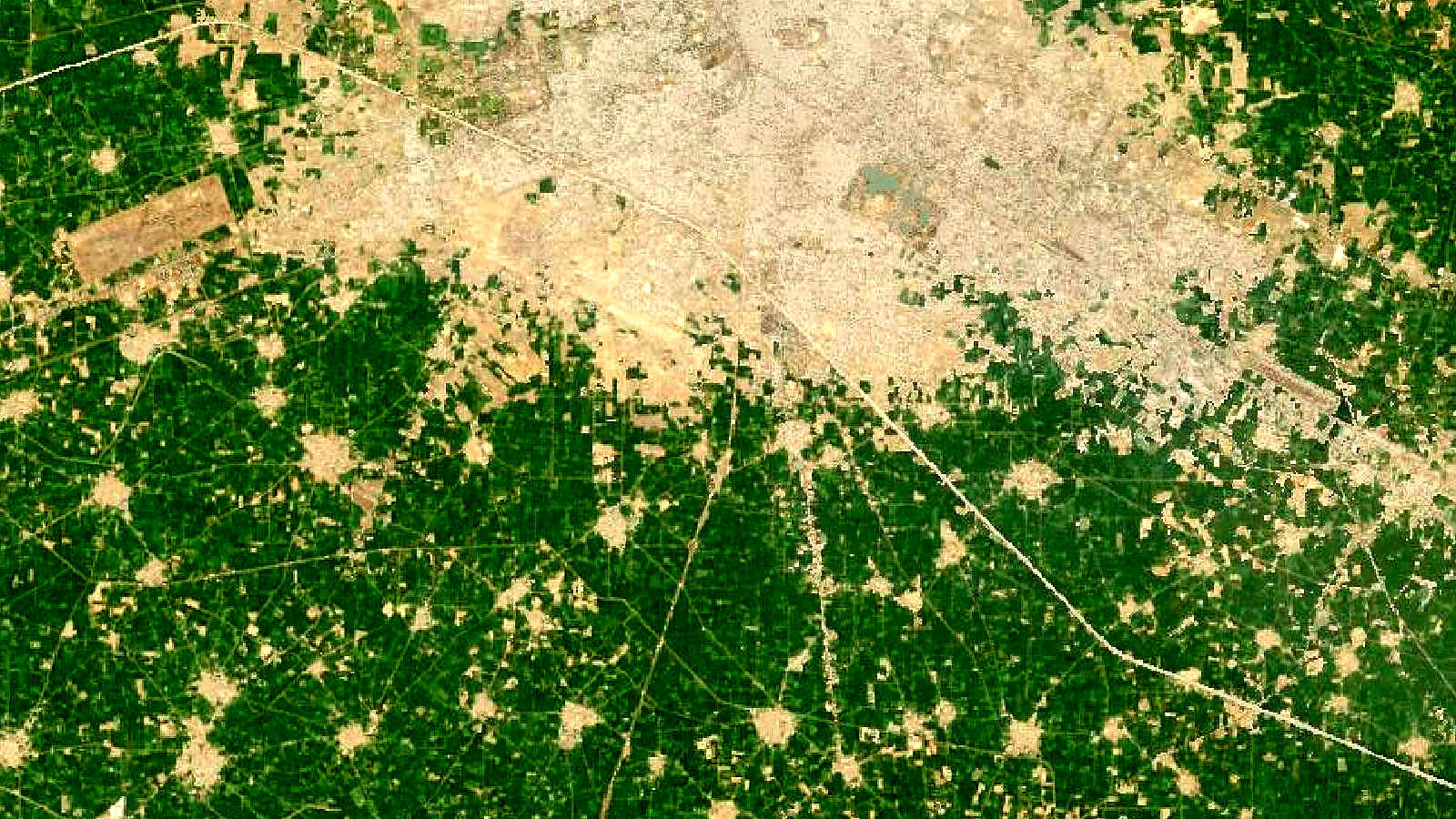
Cover image: Landsat true-colour composite of farmland mosaic near Ludhiana, Punjab (2000), NASA/USGS Landsat WELD via NASA GIBS (public domain).