RTK vs PPK GNSS: Choosing the Right Mode for Drone Surveys
RTK and PPK both deliver centimetre-level GNSS accuracy for drone surveys, but the right choice depends on your data link reliability, terrain, and post-processing workflow, a decision that matters especially across India's varied field conditions.
Why This Comparison Matters Right Now
India's drone ecosystem has expanded rapidly since the liberalised Drone Rules 2021 came into effect, and survey-grade UAVs with onboard GNSS receivers are no longer the exclusive domain of large engineering firms. Small teams, working on highway alignments, mining lease boundaries, agricultural plots, now routinely carry hardware that supports both RTK and PPK workflows. The problem is that many operators choose one mode at project setup and never revisit that choice. The result is either avoidable re-flights or false confidence in coordinates that have not been properly validated.
Understanding the RTK vs PPK GNSS drone survey decision is not about picking a winner. It is about matching a positioning strategy to your ground conditions, connectivity, and tolerance for risk.
What RTK and PPK Actually Do
Both modes use carrier-phase GNSS measurements to achieve centimetre-level accuracy, far beyond what standalone GPS can deliver. The difference is when the corrections are applied.
RTK (Real-Time Kinematic) applies corrections during the flight itself. A base station (or a network correction service such as a CORS network) broadcasts differential corrections to the drone via a radio or cellular data link. The drone's onboard receiver resolves integer ambiguities on the fly and tags each image with a corrected position in real time.
PPK (Post-Processed Kinematic) records raw GNSS observations on both the drone and a base station. After the flight, dedicated software, such as Emlid Studio, Trimble Business Center, or open-source RTKLIB, processes the two observation files together and resolves ambiguities in the office. The corrected positions are then applied to the image geotags.
The physics of ambiguity resolution is identical; only the timing differs.
When Does RTK Make More Sense?
RTK shines when you need to make decisions in the field and cannot afford to wait for post-processing.
- Time-critical deliverables: If a client needs a preliminary point cloud by end of day, RTK lets you verify coordinate quality before you pack up.
- Stable, open-sky environments: Agricultural plains, coastal flats, and open mining benches in India give RTK the clean satellite geometry it needs to maintain a fixed solution throughout the flight.
- Reliable data link: Urban fringe areas with good cellular coverage, or compact sites where a radio link to a base station stays unbroken, are well suited to RTK.
- Fewer GCPs: A well-functioning RTK system can reduce your ground control point (GCP) requirement significantly, which matters on large or access-restricted sites.
The critical caveat: if the RTK link drops mid-flight and the receiver falls back to a float solution, those image tags carry degraded accuracy, and you may not notice until you process the data. Some systems log solution quality per image; always check this.
When Does PPK Make More Sense?
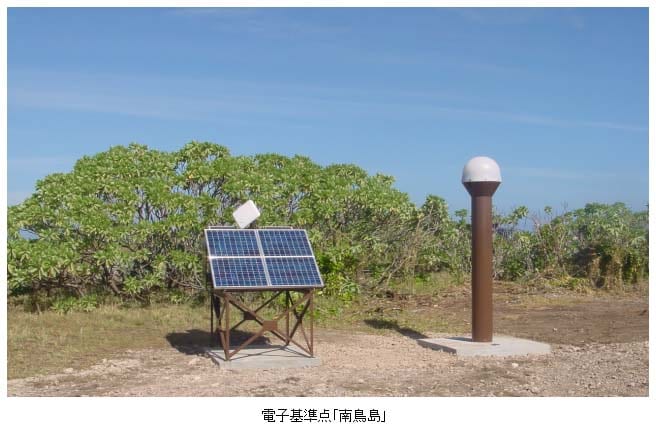
Illustrative: GNSS base station field setup. "GNSS-based control station in Minami-Tori-shima" by 国土交通省国土地理院 is licensed under CC BY 4.0. To view a copy of this license, visit https://creativecommons.org/licenses/by/4.0/.
PPK is more forgiving of the conditions that Indian field teams frequently encounter.
- Interrupted data links: Hilly terrain in the Northeast, dense urban canyons in Mumbai or Delhi, or forested corridors can break a radio or cellular link repeatedly. PPK sidesteps this entirely, the base station logs silently while the drone flies.
- Remote sites without cellular coverage: A base station running on a charged battery and logging RINEX data needs no network. This is a significant operational advantage in areas where 4G is patchy.
- Data recovery after a link failure: Because PPK processes everything after the fact, a temporary signal outage during flight is not a disaster. The post-processing software can often bridge short gaps using the continuous raw log.
- Audit trails and reprocessing: Raw RINEX files are archivable. If a client disputes accuracy six months later, you can reprocess with updated precise ephemerides or a different base station.
A Worked Example: Highway Corridor Survey in Hilly Terrain
Imagine a 12 km road alignment survey in a hilly district of Himachal Pradesh. The site has:
- Moderate tree cover on valley slopes
- No cellular signal for roughly 40% of the corridor
- A nearby Survey of India benchmark within 5 km
RTK attempt: The drone launches with a cellular-linked RTK correction. Within the first 2 km (open valley floor), the fix is solid. As the corridor climbs into a forested spur, the cellular link drops. The receiver logs a float solution for 8 minutes before reconnecting. Those images now carry positional uncertainty of potentially several decimetres, indistinguishable in the EXIF tags from the fixed-solution images unless the operator checks per-image solution logs.
PPK approach: A dual-frequency base station is set up on the benchmark and left logging at 1 Hz. The drone flies all three sorties without any link dependency. Back in the office, the RINEX files from the base and drone are processed together. The software flags two short multipath events but resolves ambiguity across the full corridor. The operator validates the output against four check points and achieves consistent residuals.
The PPK workflow added roughly 90 minutes of office processing time but eliminated the risk of undetected degraded accuracy in the field.
The Role of GCPs in Both Workflows
Neither RTK nor PPK eliminates the need for independent quality checks. Ground control points serve two functions: they constrain the photogrammetric bundle adjustment, and they provide an independent accuracy check (when used as check points rather than control).
A common field practice is to use a small number of GCPs (three to five on a compact site) alongside RTK or PPK geotagging. The GCPs catch systematic errors, such as a base station set up on an incorrectly identified benchmark, or a lever-arm offset between the GNSS antenna and the camera that was never calibrated. On large sites where GCP placement is logistically difficult, the RTK/PPK workflow carries more weight, which makes the integrity of the base station setup even more important.
Practical Checklist Before Choosing a Mode
Use this before each project, not just once when you buy the hardware:
- Check cellular/radio coverage across the full flight area, not just at the launch point.
- Identify a nearby control point (Survey of India benchmark, CORS station, or a point you have established by static GNSS) for your base station.
- Assess sky visibility along the flight path, dense canopy or steep valley walls affect both modes but are a link-loss risk specifically for RTK.
- Confirm your drone logs per-image solution status if using RTK, float images must be identified and either reprocessed or flagged.
- Budget post-processing time for PPK, typically one to two hours for a standard corridor, more for multi-day campaigns.
- Plan at least two to four independent check points regardless of mode, placed away from GCPs used in the adjustment.
Summary: A Side-by-Side View
| Factor | RTK | PPK |
|---|---|---|
| Correction timing | Real-time, in flight | Post-flight, in office |
| Link dependency | Yes, radio or cellular | No |
| Recovery from link loss | Limited (float solution risk) | Good (raw logs are complete) |
| Field decision speed | Fast | Slower |
| Reprocessing flexibility | Low | High |
| Suited to remote/hilly India | Moderate | High |
The RTK vs PPK GNSS drone survey decision ultimately comes down to your site, your data link reliability, and how much risk you can absorb in the field versus the office. For most survey teams working across India's varied terrain, PPK offers a more robust safety net, but RTK earns its place on open, well-connected sites where speed matters.
Frequently asked questions
What's the key difference between RTK and PPK GNSS positioning?
Both achieve centimetre-level accuracy using carrier-phase GNSS, but RTK applies corrections in real time during flight via a radio or cellular link, while PPK records raw data and processes corrections afterward in the office.
Why might PPK be better suited to hilly Indian terrain than RTK?
PPK doesn't depend on a live data link, so it isn't affected by the broken radio or cellular signals common in hilly terrain like the Northeast or forested corridors, where RTK risks a degraded float solution.
Do RTK or PPK eliminate the need for ground control points?
No. Neither mode removes the need for GCPs, which constrain the photogrammetric bundle adjustment and provide an independent accuracy check; a common practice is three to five GCPs on a compact site.
What happens if an RTK link drops during a drone survey?
If the RTK link drops mid-flight, the receiver falls back to a float solution, and those image tags carry degraded accuracy that may go unnoticed unless the operator checks per-image solution logs.
References
No specific external studies were cited in this article. The operational guidance is based on established GNSS surveying principles and field practice.
Researched and drafted with AI assistance.
Cover image: Landsat true-colour composite of the Ganga between Rishikesh and Haridwar (2000), NASA/USGS Landsat WELD via NASA GIBS (public domain).