Use Survey of India CORS to Build QGIS Control
A field-to-QGIS workflow for using Survey of India CORS observations to establish documented control for drainage and asset mapping in Kuttanad, Kerala.
- Published
- Reading time
- 9 min
- Place
- Kuttanad, Kerala, India
- By
- Jannat Khosla
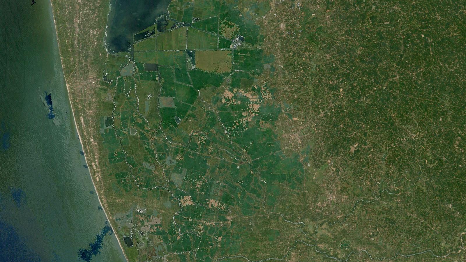
Cover: Landsat imagery of Kuttanad, Kerala, India, NASA (public domain).
A better starting point for field GIS in Kuttanad
When a mapping job needs reliable coordinates, the tempting shortcut is to collect points with a phone, load them into QGIS and begin digitising. That can be adequate for reconnaissance, but it is a weak foundation for work involving drainage alignments, culvert locations, parcel-side assets or repeat surveys. The problem is rarely QGIS. It is the missing record of how the field coordinates relate to a recognised reference frame.
Survey of India’s Continuously Operating Reference Stations, usually called CORS, give Indian survey teams a route to that reference frame. The agency’s CORS page lists procedures for registration and data download, DGNSS surveying, NRTK surveying, online post-processing and virtual RINEX download. Its CORS map also lets users search stations by state, nearest station or a chosen buffer around a point. Survey of India CORS services CORS stations map
This is not a post about choosing RTK over PPK for a drone flight. It is about a more basic GIS task: establishing a small set of field control points, documenting them properly, then using those points in a QGIS project without quietly mixing coordinate systems, heights and position qualities.
Kuttanad, in Alappuzha district, Kerala, is a useful example. Its low-lying paddy landscape is crossed by canals, bunds and narrow roads. A misplaced point can put an asset on the wrong side of a watercourse in a map that otherwise appears convincing. The workflow applies elsewhere in India, but the flat, water-managed setting makes its assumptions visible.
Decide what the control must support
Before opening the CORS portal, write a short control brief. In this example, the aim is to map drainage structures and produce a QGIS GeoPackage that another analyst can revisit six months later. The brief should say whether points are for general GIS reference, digitising from imagery, construction set-out, or a survey requiring formal engineering checks. Those are different jobs.
Choose durable, accessible locations for control. A painted kerb edge, the centre of a temporary cover or a point beside parked vehicles will not serve a repeat visit. In Kuttanad, a bridge corner, a permanent culvert headwall or a stable roadside monument may be better candidates, provided the antenna can view the sky and the point can be described unambiguously.
Use a survey-grade receiver and field software compatible with the CORS service you intend to use. Survey of India states that its network RTK service requires an RTK-compatible dual- or multi-constellation GNSS receiver, controller, field-survey software, internet connectivity and valid credentials. The same source describes DGNSS as a different service, with a different expected positioning range, so do not call a code-based DGNSS fix an RTK fix in a deliverable. Survey of India National Workshop report
The equipment is only one part of the evidence. Record the receiver model, antenna type, pole height, observation method, start and end time, fix status, reported horizontal and vertical quality, number of observations and field operator. If the receiver exports a raw observation file, retain it with the project. A coordinate without its method is an assertion, not usable control.
Worked example: control points for a canal inventory
Assume a team needs control around the Thakazhy area for a canal and culvert inventory. They will establish five reference points before collecting asset locations.
First, use the Survey of India CORS map to inspect stations around the field area. Search by state, then use the buffer tool from the project location. The map presents station status and information panels, so check the current status on the day of work rather than relying on an old screenshot. This does not guarantee a survey solution, but it is a sensible pre-field check. CORS stations map
Second, register for the required service and follow the current Survey of India procedure. The agency distinguishes real-time corrections from reference-data services. Its published workshop material says that CORS raw observations can be ordered in RINEX or virtual RINEX form for static post-processing, while its online processing service accepts a GPS data file from a survey-grade receiver and returns a computation report. Access requires the relevant credentials. Survey of India National Workshop report
For this example, occupy each selected point in static mode and retain the raw file. Static work is a reasonable choice when creating a small control set that must be repeatable, especially if mobile coverage is inconsistent near the field site. Survey of India describes static observation with CORS reference data as the recommended method for establishing high-precision survey reference points and says users can request data by format, frequency, station, date, time and observation period. Confirm the actual order choices and processing report before treating any coordinate as final.
Third, create a field-control register. It can start as a spreadsheet, but it should become a permanent table inside the project GeoPackage. Use columns such as control_id, feature_description, method, observation_start, observation_end, solution_status, horizontal_quality, vertical_quality, antenna_height, source_file, cros_service, crs, height_type and notes. Preserve the processing report alongside the raw observations.
Fourth, bring the final coordinates into QGIS. A CSV with longitude and latitude can be loaded through Data Source Manager, while a GPX file can be added through the GPX option. QGIS documentation explains that GPX can contain waypoints, routes and tracks, which load as separate layer types. It also warns that QGIS expects GPX latitude and longitude to use WGS 84, as required by the GPX specification. QGIS GPS data documentation
Set the input CRS correctly when importing. Do not select a local projected CRS merely because the project map uses metres. If the file contains WGS 84 longitude and latitude, declare that honestly, then save a copy into the project CRS. For a compact Kuttanad mapping job, a suitable projected CRS may make distance and area work more convenient, but the appropriate choice depends on the client specification and the coordinate reference named in the CORS solution.
Fifth, save the imported control as a GeoPackage layer and attach its supporting documents in a clear folder structure. In QGIS, label points with control_id and use a separate symbol for points whose solution has not been accepted. This matters because a field team often returns with a mixture of completed and provisional observations.
Now assess the points before using them as control. Overlay them on recent imagery, drainage centre lines and road edges, but do not reject a point simply because an image layer looks offset. Web imagery may have its own positional error or capture date. Look instead for internal consistency: do repeated occupations agree within the expected quality stated in the solution reports, and do coordinates, descriptions and photographs identify the same physical mark?
If the five points pass review, collect the culvert and canal assets using the same documented method. Store the field quality attributes with every asset, not only with the control points. A future user then knows which features were surveyed and which were digitised from imagery.
The mistake that causes quiet map shifts
The common beginner mistake is mixing horizontal coordinates and height values as though they are all expressed in the same reference. A GNSS receiver may report an ellipsoidal height, while a drainage design or benchmark record may use an orthometric height. They are not interchangeable.
Survey of India’s geodetic material distinguishes a GNSS or ellipsoidal height from height referenced to mean sea level, and describes ongoing vertical-reference work. In a low-relief landscape such as Kuttanad, a casually copied height can make a drainage profile appear more certain than it is. Survey of India National Workshop report
Avoid this by adding a height_type field to every control record. Enter values such as ellipsoidal, orthometric, unknown or the precisely named datum supplied by the authority. If the project needs hydraulic or engineering levels, obtain the required vertical reference and conversion guidance. Do not use an unlabelled GNSS height as a substitute.
A related error is converting a CSV to a new CRS, then overwriting the source file. Retain the original export, its declared CRS and the processed copy. QGIS can display layers together through on-the-fly transformation, but it cannot repair a coordinate that was assigned the wrong CRS at import.
Make the QGIS project reviewable
A useful project contains more than a point layer. Add a plain-language README in the project folder stating the survey purpose, coordinate reference system, vertical treatment, dates, CORS service used, receiver and software, quality acceptance rule, and known limitations. Include a link to the current Survey of India CORS service page because procedures and access arrangements can change.
In QGIS, use a GeoPackage rather than separate loose shapefiles for the control layer, asset layer and field notes. Keep a non-editable copy of accepted control. Use forms to make essential fields mandatory when adding new assets. For repeat visits, load the accepted control points as a reference layer and compare the new occupation with the established point before collecting a full day of data.
The result is a GIS dataset whose location claims can be checked. That is more valuable than a set of attractive points with no survey history.
Frequently asked questions
Can I use Survey of India CORS with a phone GPS?
No, a phone position is not a substitute for the receiver and method required by the CORS service. Survey of India specifies compatible survey equipment and credentials for network corrections. A phone can still be useful for reconnaissance, photographs and non-control observations.
Should I use GPX or CSV in QGIS?
Either can work, provided the coordinate reference is documented. GPX is convenient for waypoints and tracks, while CSV suits a control register with survey attributes. QGIS expects GPX latitude and longitude in WGS 84, so check the export setting.
Are CORS heights ready for drainage design?
Not automatically. GNSS-derived ellipsoidal heights and project-required physical heights may use different references. Record the height type, consult the relevant vertical-datum guidance and use established benchmarks or approved conversions when the design requires them.
How many control points does a small GIS project need?
There is no universal number. Use enough well-described, accessible points to check the work across the survey area and support the intended task. Five points can be a useful small network, but point placement and observation quality matter more than a fixed count.
References
- Survey of India, Continuously Operating Reference Stations
- Survey of India, CORS Stations Map
- Survey of India, National Workshop report, CORS services and vertical datum
- QGIS documentation, introducing GNSS/GPS data
Researched and drafted with AI assistance; sources are linked for verification.
Need this done for your own study area? Send me the area and what you need.
Cite this post
Khosla, J. (2026, November 9). Use Survey of India CORS to Build QGIS Control. Jannat Khosla. https://jannatkhosla.com/blog/use-survey-of-india-cors-to-build-qgis-control
› BibTeX
@online{khosla2026survey,
  author = {Khosla, Jannat},
  title = {Use Survey of India CORS to Build QGIS Control},
  date = {2026-11-09},
  url = {https://jannatkhosla.com/blog/use-survey-of-india-cors-to-build-qgis-control}
}